Ásbyrgi to Dettifoss - Canyon Trail
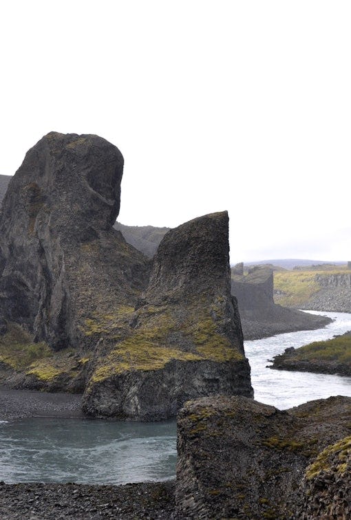
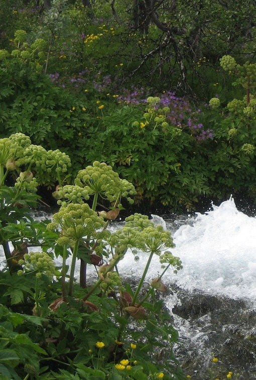
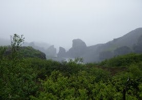
The trail between Ásbyrgi and Dettifoss is 32 kilometers through Jökulsárgljúfur canyoun. Points of interest Jökulsárgljúfrum. Hiking up along the Jökulsárgljúfur canyon, from the luxuriant Ásbyrgi to the barren but magnificent environment around Dettifoss, is a unique experience for every hiker. The diversity of the landscape is unique and captures the eye at every footstep: tremendous gorges, quiet ponds, clear springs, rough river, luxuriant forests and bare gravel plains. Two days are recommended for the whole hike. On the route there are no cabins and it is only allowed to camp on the park campsites at Vesturdalur and Dettifoss.
The canyon trail - 3 parts
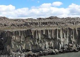
Ásbyrgi - Vesturdalur
From Ásbyrgi to Vesturdalur there are two paths to choose from: One is to follow the rim of Ásbyrgi, and go south along Klappir and Kvíar, just over 12 km. The other route is to go the easterly path, closer to the river, but that route is 13,6 km long. Both routes start at the Visitor Centre in Ásbyrgi. The trail is a part of the canyon trail from Ásbyrgi to Dettifoss, 32 kilometers in total.
Vesturdalur - Hólmatungur
The route between Vesturdalur and Hólmatungur is about 8 km. The only river that has to be waded during the hike, Stallá, is at this section. Stallá is a spring river that flows into the Jökulsá river. The river is shallow and cold, but wading restores tired legs and makes the trip more memorable. The trail is a part of the canyon trail between Ásbyrgi and Dettifoss that is 32 kilometers.
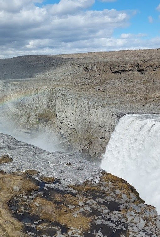
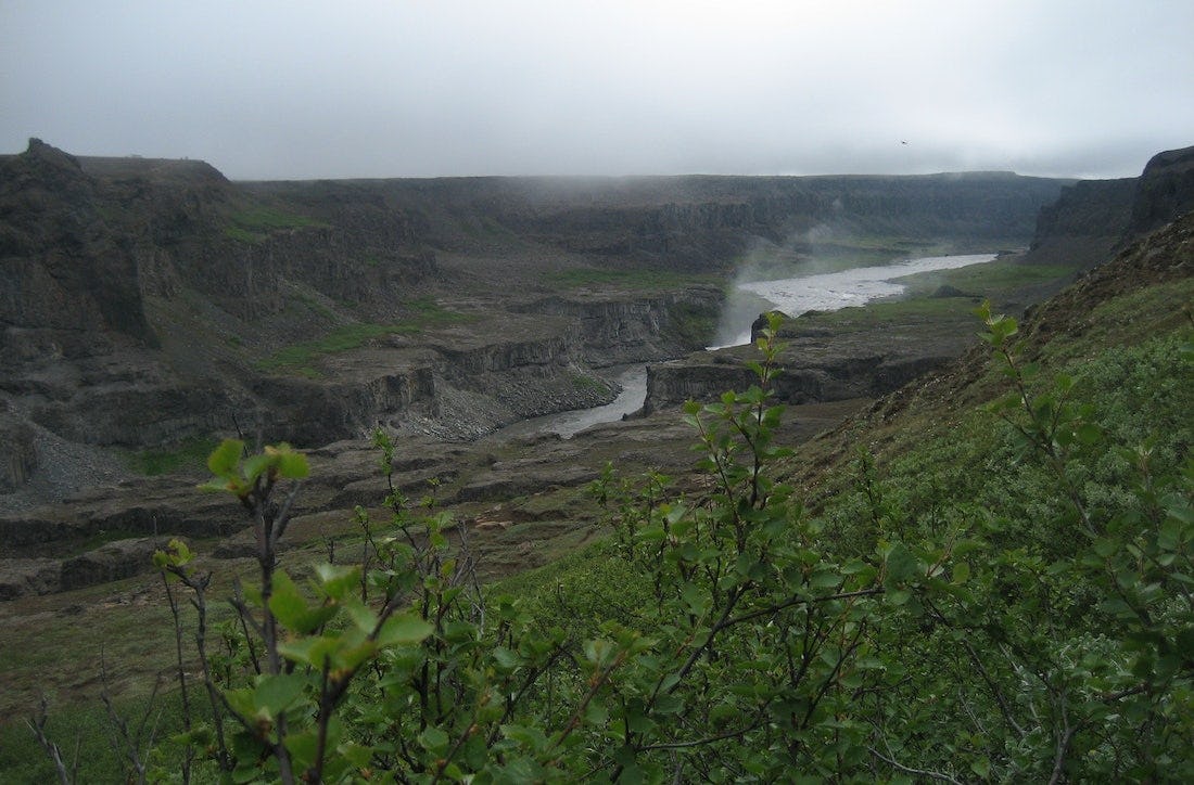
Hólmatungur - Dettifoss
The trail is from Hólmatungur to Dettifoss. The trail is one of three parts for hiking the whole Jökulsárgljúfur, 32 kilometers in total.
Route description
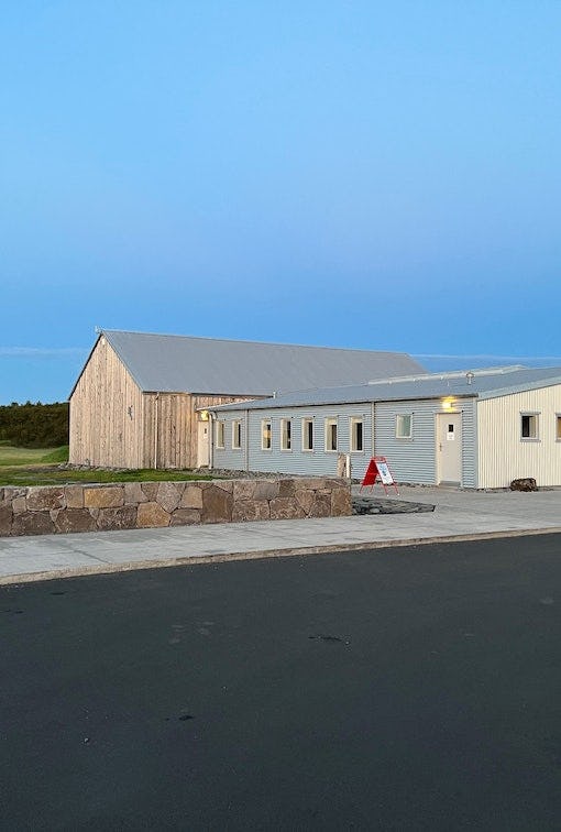
It takes two days to hike between Ásbyrgi and Dettifoss and normally lodged in Vesturdalur (Hljóðaklettar). The route can be walked in both directions (start ingeither in Ásbyrgi or Dettifoss). In Jökulsárgljúfur it is only allowed to camp at the official campsites in Ásbyrgi, Vesturdalur and at Dettifoss (a small campsite with few facilities). From Ásbyrgi to Vesturdalur there are two paths to choose from: One is to follow the rim of Ásbyrgi, and go south along Klappir and Kvíar, just over 12 km. The other route is to go the easterly path, closer to the river, but that route is 13,6 km long. Both routes start at the Visitor Centre in Ásbyrgi. From the Visitor Centre, there are two ways to access the rim of Ásbyrgi. An easier way is to go east over the golf course and turn south at the intersection east of the golf course. From there the path goes up the lowest part of the cliff. A more difficult way is to go directly south from the Visitor Centre, towards the intersection at Tófugjá. There, turn east and go up the cliff, where there is a rope for support. It is not recommended to go this way if people have a heavy burden. Up at Tófugjá it is possible to choose which way to go to Vesturdalur (along the rim of Ásbyrgi or along the Jökulsá river).
The route between Vesturdalur and Hólmatungur is about 8 km. The only river that has to be waded during the hike, Stallá, is at this section. Stallá is a spring river that flows into the Jökulsá river. The river is shallow and cold, but wading restores tired legs and makes the trip more memorable.
From Hólmatungur there is roughly a 10 km hike south to Dettifoss, if you go into the Hafragil lowland (black route). If you go along the Hafragil ravine the route is 11,5 km. It is not recommended for people with a heavy burden to go down to the lowland. In that case, hikers are advised to go to the campsite at Dettifoss, ease the burden and then explore the lowland.