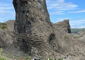
Hljóðaklettar
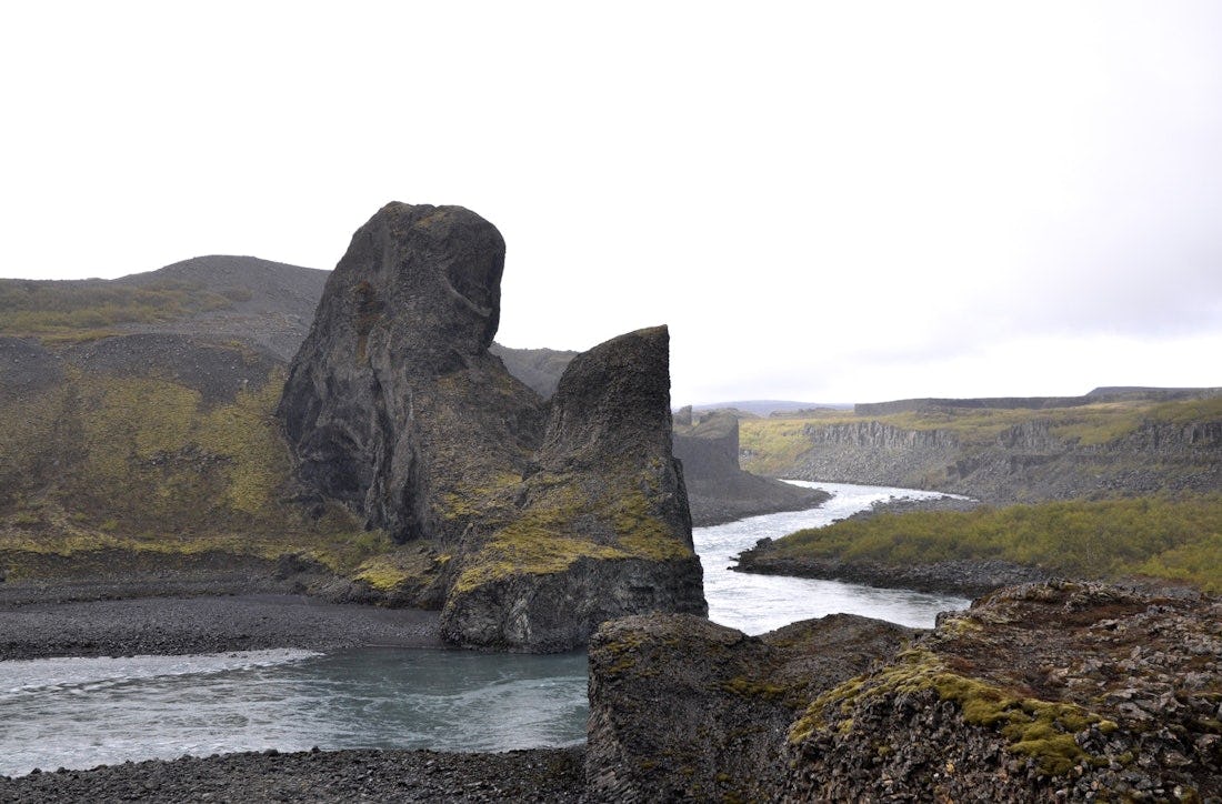
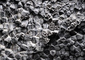
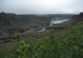
Hljóðaklettar and Rauðhólar are part of a ca. 6 km long row of craters that erupted about 8000-9000 years ago. In the beginning, most of the craters looked like Rauðhólar, but Jökulsá has swept the loose earth materials away from most of them in outburst floods during natural catastrophes and left only the basic structures. The best known among these are Hljóðaklettar, although such basic structures can be seen in other places of the crater row on both sides of Jökulsá. There it can be seen how the magma has solidified in the volcanic conduit to form many kinds of unique rock formations, which are a rare sight on a global level.
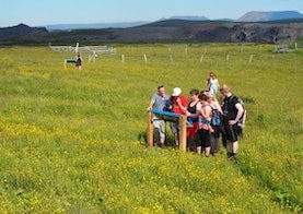
Hljóðaklettar are situated at Vesturdalur, about 15 km south of Ásbyrgi, and can be reached by a paved road. There is good access for every visitor from the car park at Langavatnshöfði, and a good view of the crater row. From the car park by Hljóðaklettar there are marked hiking routes around the area, and there is also a connection to the hiking routes from Dettifoss and Hólmatungur from the south and Ásbyrgi from the north. While hiking in the area, it is worthwhile to pay attention to the place that emanates the sound of the water flowing in Jökulsá á Fjöllum, and to ponder why the rocks are named Hljóðaklettar (sounding rocks).
It is proper to state that due to the risk of damage to vegetation hikers are prohibited from walking outside the marked footpaths at Hljóðaklettar and Rauðhólar.
The rock formations of Hljóðaklettar have taken on various shapes, some of which have been given names by people over the years. Tröllkarlinn, Kirkjan and Karl og Kerling are among the best known such names. Kirkjan is a domed cave that was given its name (“the church”) at an early stage, whereas tales about Tröllkarlinn ("the giant troll") and Karl og Kerling ("geezer and crone") originated in the tales about the settlement of the
Hiking trails in Hljóðaklettar and Vesturdalur
Eyjan in Vesturdalur
Points of interest: Viewpoints, ponds and birds. A recommended evening walk.
Hljóðaklettar - Tröllið (Echo rocks)
Points of interest: Cliff aucoustics near Jökulsá river and unique geolocial phenomena; basalt columns and honeycomb weathering.
Hljóðaklettar circle (Echo rocks)
Points of interest: Cliff acoustics near Jökulsá river and unique geolocial phenomena; basalt columns, cliffs, honeycomb weathering and caves.
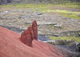
Rauðhólar (Red hills)
Points of interest: View over Jökulsá river and Hljóðaklettar, geological pheomena, folk tale.
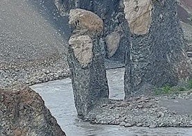
Karl and Kerling cliffs
Points of interest: History, ruins of varying ages, Jökulsá river and geological phenimena.
Svínadalur circle
The trail starts at the parking area at Hljóðaklettar and goes south past the old Trolls, Karl and Kerling and towards Kallbjarg. In the last century there was a pulley over the river at Kallbjarg, which was used to transport essentials from one side to the other. From Kallbjarg the route heads west to the farm Svínadalur, deserted since 1946 and then it turns north. The trail goes over Eyjan (the Island) and then it goes down into the Vesturdalur valley and goes along the Vesturdalsá River to the camp site. From there the easiest way back to the parking area is to follow the road.
Ásbyrgi to Dettifoss - Canyon Trail
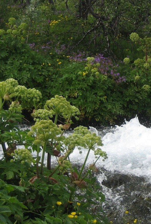
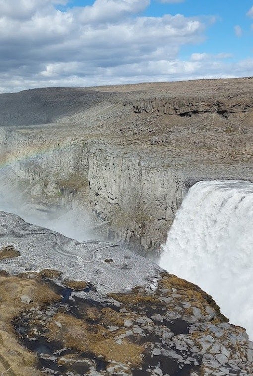
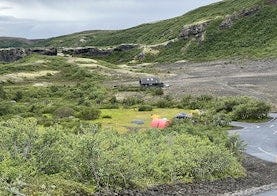
The trail between Ásbyrgi and Dettifoss is 32 kilometers through Jökulsárgljúfur canyoun. Points of interest Jökulsárgljúfrum. Hiking up along the Jökulsárgljúfur canyon, from the luxuriant Ásbyrgi to the barren but magnificent environment around Dettifoss, is a unique experience for every hiker. The diversity of the landscape is unique and captures the eye at every footstep: tremendous gorges, quiet ponds, clear springs, rough river, luxuriant forests and bare gravel plains. Two days are recommended for the whole hike. On the route there are no cabins and it is only allowed to camp on the park campsites at Vesturdalur and Dettifoss.