Glaciological research
Researching the glacier and weather tells us about the past and the future. It is important work to monitor the glaciers and some of the work has even been carried out by volunteers from the Iceland Glaciological Society since 1903.
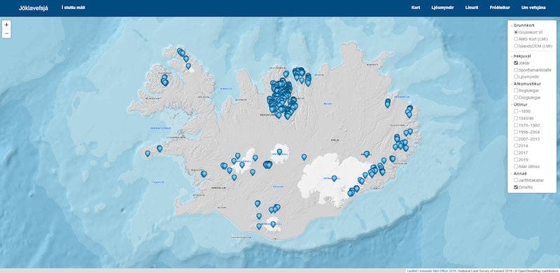
Glacier web portal
The glacier web portal is a collaborative effort to displays measurements of glaciers and an overview of glaciological research and variations of Icelandic glaciers. The portal provides access to regular glaciological measurements and observations that are carried out by Icelandic institutes, agencies, companies, societies and private persons.
Mass balance and meteorological measurements
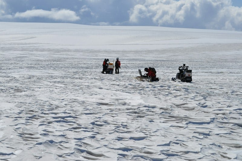
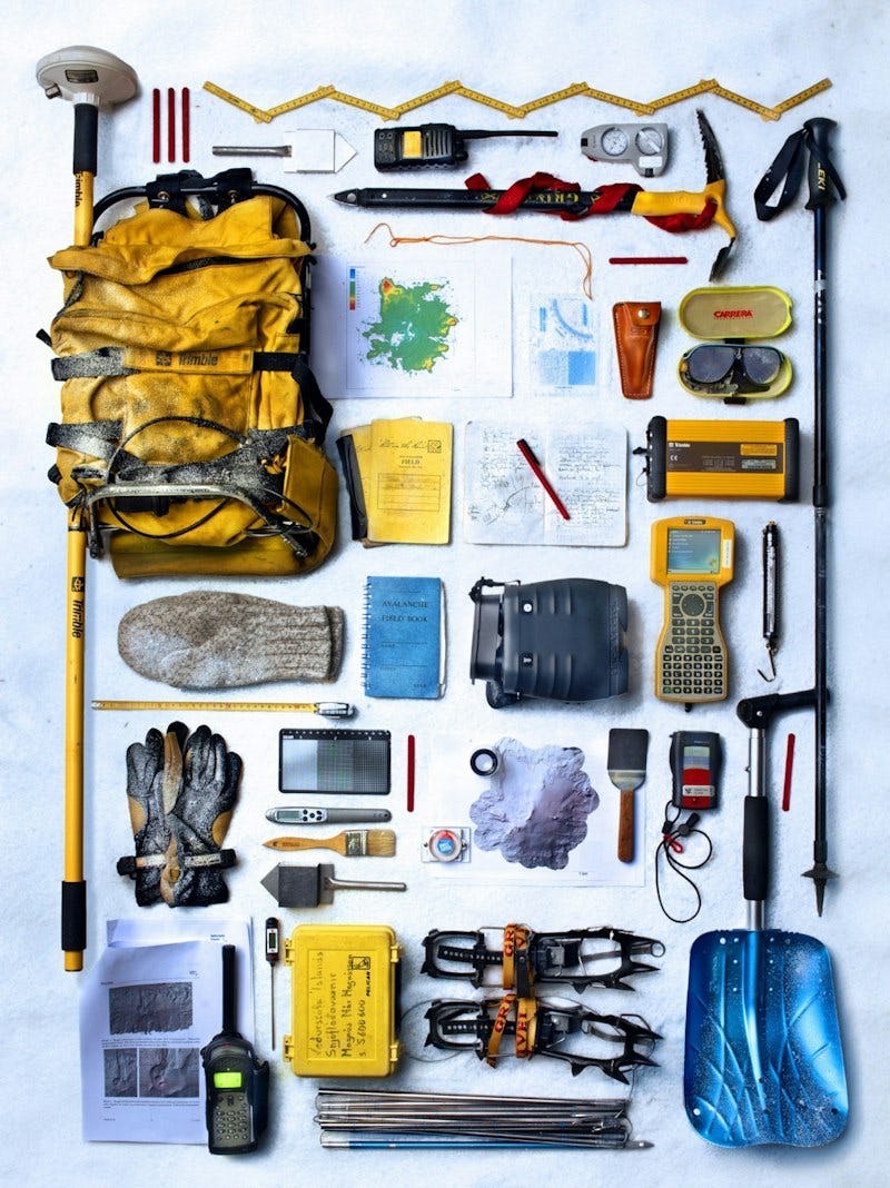
Regular mass balance monitoring of Vatnajökull has been carried out since 1992 in cooperation between the Institute of Earth Sciences of the University of Iceland and the National Power Company. The accumulation of snow is measured in the spring by drilling cores through the winter snowpack and the ablation of snow and ice by measuring changes in the height of stakes or the length of wires left in boreholes drilled into the glacier ice. The resulting mass balance data set is used in studies of glacier volume changes, to estimate meltwater contribution to glacial rivers (runoff), in mass balance modelling and to evaluate altitudinal and regional variations of mass balance in response to climatic variations. Mass balance maps have been derived, using the mass balance measurements and observed vertical mass balance gradient (that is the statistical relation between elevation and mass balance).
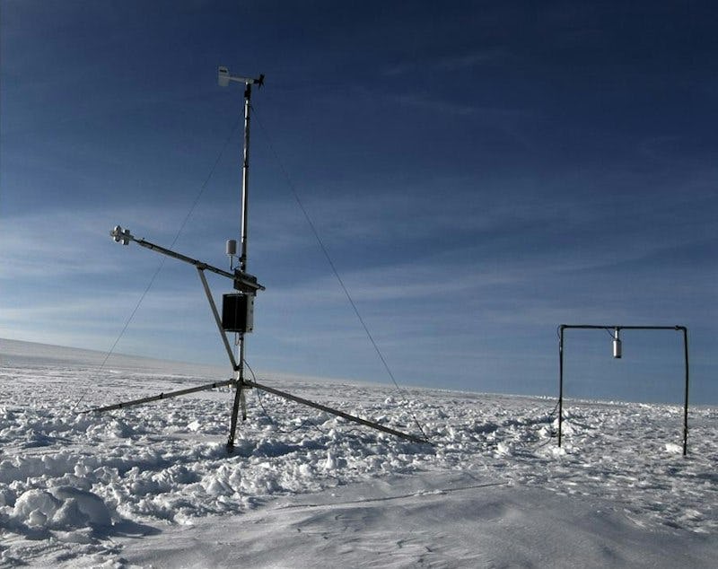
Automatic weather stations have been operated on the ice cap in summer since 1994. They measure temperature, relative humidity, wind speed and wind direction, as well as radiation components. The meteorological data are used to estimate the relationship between melting and weather components. The data are also used in mass balance modelling.
The influence of volcanic tephra and dust from the sandur plains on the mass balance of the ice cap has been studied extensively. Deposition of small amounts of airborne dust on glaciers can cause enhanced melting due to the reduction of surface albedo. However, the thickness of the tephra or dust plays a decisive role. A thin layer increases the snow and ice melt but a layer exceeding ca. 10–15 mm in thickness causes insulation. The influence of volcanic ash is strong immediately following an eruption, but the tephra is rapidly covered by winter snow in the accumulation area and washed away in the ablation area.
The Breiðamerkurjökull outlet glacier retreats and thins due to negative surface mass balance in a warming climate but also due to calving into Jökulsárlón lagoon. Calving currently causes about 1/3 of the mass loss of Breiðamerkurjökull.
Radio-echo sounding measurements
Systematic mapping of the bedrock beneath Vatnajökull by radio-echo sounding measurements began in 1980. The radio-echo sounding device is hauled with a snowmobile or snow sledge to measure continuous profiles of reflected radio waves. The travel time of the wave reflected from the glacier bed is recorded and from this the ice thick¬ness can be calculated. Altogether, approximately 10,000 km of profiles have been measured, with 200−1000 m average spacing on the ice cap. Point measurements have also been done on foot in areas where motorised vehicles cannot be used, for example in heavily crevassed areas and on the outlet glaciers of Öræfajökull. Maps of the subglacial topography have been produced by interpolation of the radio-echo sounding profiles. The high-resolution maps show previously unknown landscapes and formations including the geometry and location of volcanic systems, the possible routes of jökulhlaups, and catchment basins of glacier rivers. Deep troughs and high plateaus are hidden under the ice surface and many of the southern outlet glaciers have carved deep valleys, reaching up to 260 m below sea level.
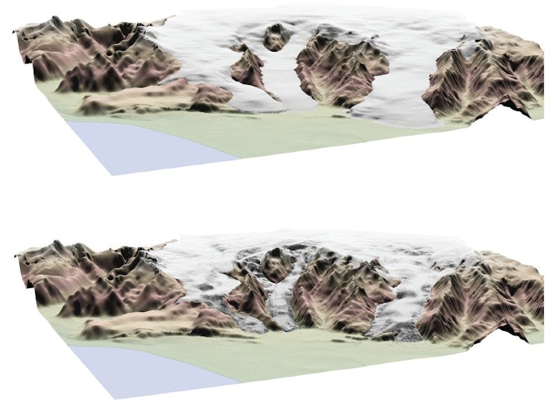
The glacier extent at different times since the end of the Little Ice Age has been delineated from glacial geomorphological formations, maps, aerial images and remote sensing data. Glacier surface maps from different times are available, including high-resolu¬tion digital elevation models (DEMs) from lidar and satellite measurements. The maps provide information about changes in ice surface geometry and they allow delineation of ice cauldrons and ice-flow basins. The maps are, furthermore, useful for studies of jökulhlaups, mapping of crevasses and they have revolutionised studies of glacier changes.
Monitoring of glacier termini
Since 1930, volunteers from the Iceland Glaciological Society have carried out regular monitoring of the snouts of many of the outlet glaciers of Vatnajökull. The monitoring involves measuring the terminus position relative to a reference point and are currently carried out annually at 35 termini country wide. The measurements, published in the journal Jökull, are a remarkable source of information about glacier variations in Iceland over a period spanning almost 100 years. They document terminus retreat and advance, and in some cases surges. The results are submitted to the international database on glacier variations, World Glacier Monitoring Service. The measurements, as well as maps showing the locations of the measurement sites and the annual reports on terminus variations, published in Jökull, are available at the glacier variations website of the Icelandic Glaciological Society.
Jöklamælingar
Útlínur jökla og yfirborðskort
Útlínur jökla á mismunandi tímum frá lokum litlu ísaldar hafa verið raktar út frájökulgörðum, kortum, loftmyndum og fjarkönnunargögnum. Kort af yfirborði jöklanna hafa verið búin til með margvíslegum aðferðum, m.a. út frá loftmyndum og GPS-mælingum, háupplausnarlíkönum, með leysimælingum og gervitunglagögnum. Kortin veita upplýsingar um hæðarbreytingar og með þeim er unnt að afmarka katla og draga ísaskil. Kortin nýtast við rannsóknir ájökulhlaupum, við kortlagningu á jökulsprungum og þau auðvelda mjög rannsóknir á jöklabreytingum.
Glacier surface velocity
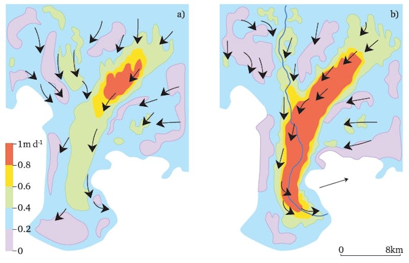
The speed of the glacier is mainly dependent on the ice thickness, surface slope, the thickness and properties of basal sediments, and the temperature of the ice, but also on the weather and the season. Surface velocities have been measured for selected outlet glaciers during the summer, using GPS instruments, and velocity maps have been compiled from satellite data. The summer velocity is typically twice the winter velocity. The larger outlet glaciers move approximately 1 m/day in summer. The velocity measurements data set maintained by the Institute of Earth Sciences at the University of Iceland and ice surface maps are important for the study of surges.
Modelling studies
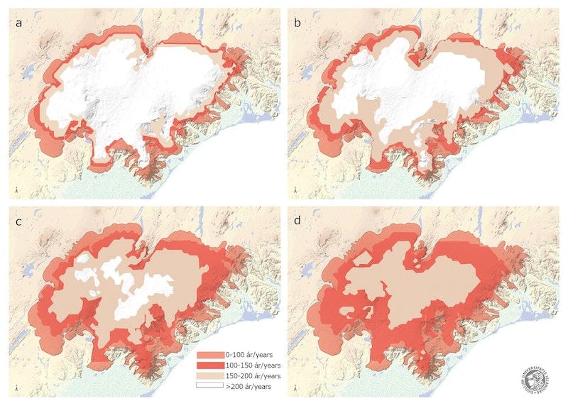
Several modelling studies of the response of the Vatnajökull ice cap to climate change have been carried out. The models indicate that after 200 years there will only be small ice caps on the highest mountains of Vatnajökull, i.e. on Öræfajökull, Bárðarbunga and on the plateau between Grímsvötn, Bárðarbunga and Kverkfjöll mountains. Vatnajökull could lose ca 25% of its current volume within the next 50 years. Simultaneously, the runoff from the ice cap will increase due to increased ablation and remain higher than today well into the 22nd century, or until the ice reservoir has been substantially depleted. These runoff changes will have an impact on the hydropower industry and other infrastructure.
Simulated areal extent of Vatnajökull for the reference model and after 100, 150, and 200 years of warming with no change in precipitation. The assumed warming rates are as follows: (a) 1°C; (b) 2°C; (c) 3°C; and (d) 4°C per century. Source: Modified after Flowers et al. (2005).
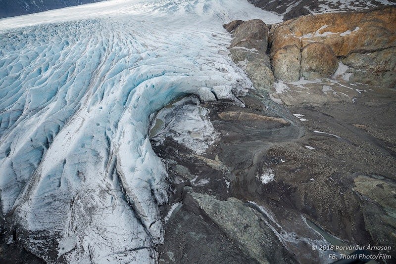
Glacial geomorphology
Textbook examples of glacial geomorphological processes and landforms can be found all around the periphery of Vatnajökull ice cap. The mapping of the forelands of receding glacier snouts aids the understanding of the nature of landform evolution and provides a modern analogue for Quaternary environments. The recently deglaciated forelands of the southern outlet glaciers of Vatnajökull constitute an ideal outdoor classroom and laboratory for studying the impacts of glaciers on landscapes. As the glaciers retreat, freshly deposited features and landforms are uncovered that are easily accessible for study and repeat measurements. The ongoing processes are characteristic of what will pertain to glacierized landscapes around the world in the coming decades and centuries as the climate continues to warm.