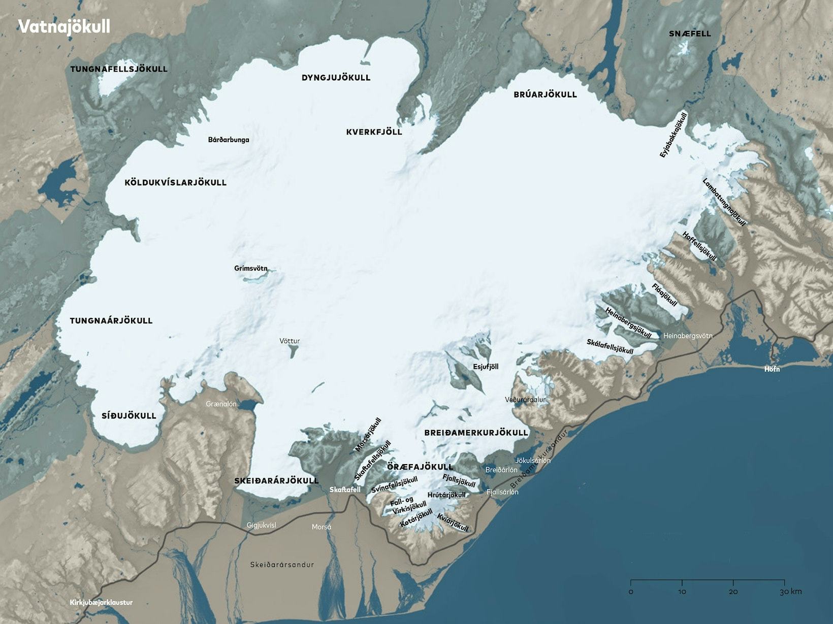
Vatnajökull ice cap
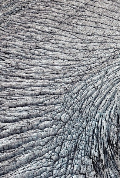
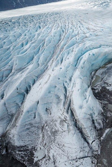
Within Vatnajökull National Park, many landscape forms bear witness to the downwasting of glaciers, which is one of the most obvious consequence of anthropogenic climate warming. At present, all the southern outlet glaciers of Vatnajökull are retreating and thinning at unprecedented rates. These glaciers reached their maximum Holocene (the last 10 000 years) size only 130 years ago, as evidenced by glacial geomorphological forms, including well preserved lateral moraines and end moraines. Some of the glaciers in the park are analogues to the glacial enviroments of the vast ice sheets of Greenland and Antarctica, and the periglacial environments parallel to the conditions at the ice margins of the continental ice sheets of the Quaternary period.
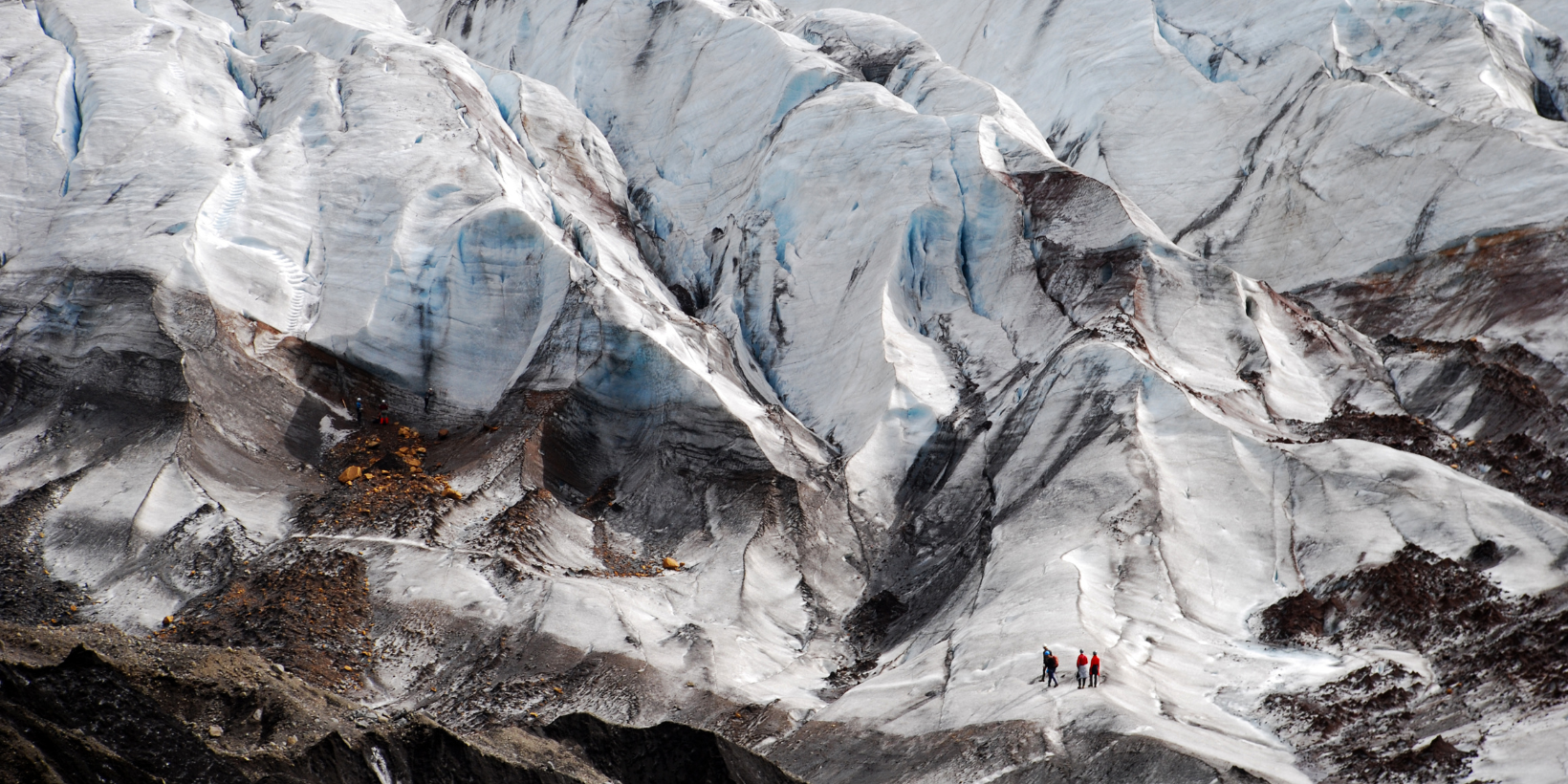
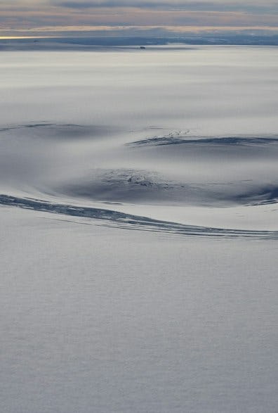
Vatnajökull is a typical temperate ice cap composed of ice domes and numerous outlet glaciers, some of which surge at irregular intervals. Vatnajökull ice cap is ca. 7700 km2 (and covers ca 8% of Iceland) and is still Europe’s largest ice cap by volume, although it has lost more than 15% of its volume during the last century. It conceals seven active central volcanoes, valleys and glacial troughs. At the locations Skaftárkatlar, Grímsvötn and Kverkfjöll, volcanism and geothermal heat maintain subglacial and marginal lakes that release outburst floods, called jökulhlaups, into some of the glacial rivers carrying meltwater from the ice cap. These floods have proved hazardous to neighbouring settlements. Jökulhlaups are also quite frequently released from ice-dammed lakes (for example Grænalón and Vatnsdalslón). The ice cap is very important for the hydrology of the surrounding areas and some of the glacial meltwater is exploited for production of electricity in hydropower plants. The ice cap is close to populated areas and travel routes and the numerous outlet glaciers are popular tourist destinations.
Facts about Vatnajökull
Fire & ice
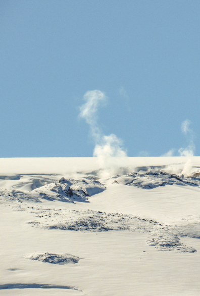
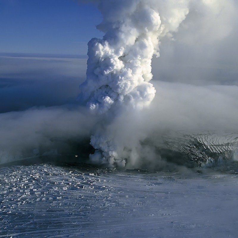
Vatnajökull conceals a part of the neovolcanic zone and seven central volcanoes, including four of the most active ones in Iceland, Grímsvötn, Bárðarbunga, Kverkfjöll and Öræfajökull. Ice–volcano interactions produce various geological formations. Subglacial eruptions lead to explosive phreatomagmatic tephra production. The tephra is quickly glued together in the moist and hot environment at the eruption site to form breccia or hyaloclastite. Hyaloclastite mountains and ridges are characteristic for the neovolcanic zone of Iceland, but rare elsewhere in the world. During the Gjálp eruption in 1996, a 7 km long hyaloclastite ridge was formed, which is now buried by the glacier. The hyaloclastite formation in Iceland was mostly created by subglacial eruptive activity during the glacial intervals of the Ice Age, when a large ice sheet covered the country.
Meltwater that accumulates during subglacial eruptions can be released in catastrophic jökulhlaups, which may be hazardous to people and infrastructure. Eruptions and jökulhlaups from steep volcanoes like Öræfajökull destabilize the glacier itself, so that large blocks of ice break off and cascade downhill like an avalanche. Landforms created by such catastrophic events are found at the foothills of Öræfajökull and formed during the eruptions in 1362 and 1727.
Changes
Vatnajökull has high mass turnover rates and is among the most sensitive ice caps worldwide to climate change. Studies of the history of climate variations and their effect on the ice cap is an important contribution to glaciological research. Knowledge and understanding of glaciological processes, is necessary to be able to predict the future evolution of the ice cap. Vatnajökull has been the subject of scientific research for decades and even centuries, with the first detailed description of the outlet glaciers dating to the latter part of the 18th century. The easy motorized access to the interior of Vatnajökull and the huts and facilities of the Icelandic Glaciological Society have facilitated research on the ice cap. Vatnajökull, with its accessible outlet glaciers and surrounding periglacial landscapes, can be considered a natural laboratory for glaciological, geological and biological research. Each year several research expeditions are carried out.
Formation of the ice cap
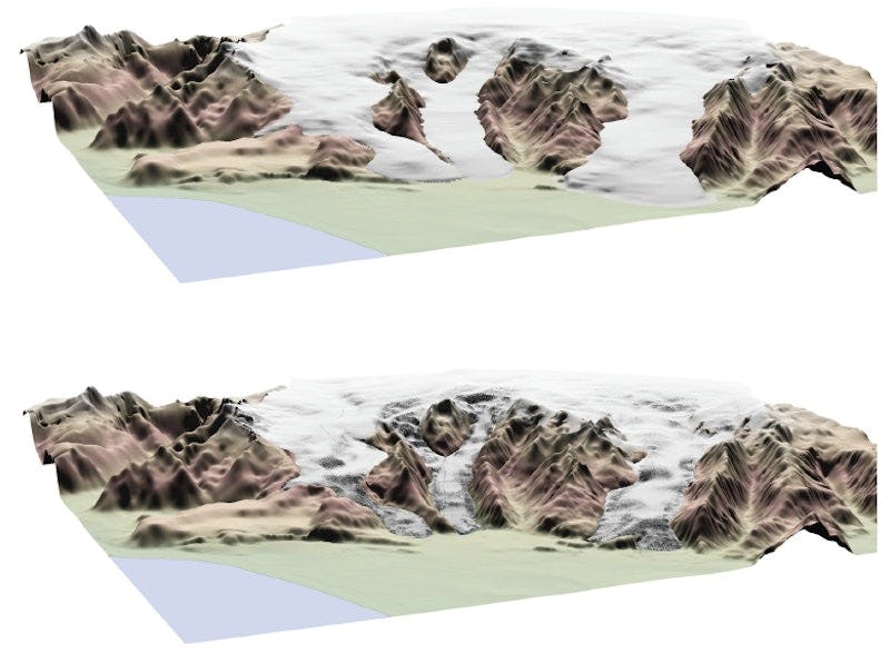
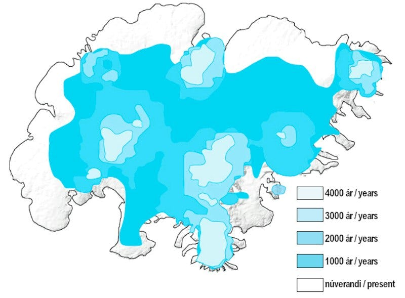
Vatnajökull is not a remnant of the Weichselian/Wisconsinan ice sheet that covered Iceland entirely during the Last Glacial Maximum around 18,000 years ago. The sedimentary record from lake Lagarfljót northeast of the ice cap, receiving meltwater from the Eyjabakkajökull outlet glacier, sheds light on the Holocene development of Vatnajökull. By about 9000 years ago, no glacial sediments can be detected and during the warmest period of the Holocene (5000–8000 years ago), the large Weichselian ice sheet had disappeared and probably only small glaciers remained on the highest mountains. The return of glacial meltwater to lake Lagarfljót (signifying the return of Eyjabakkajökull) is dated to ca. 4500 years ago. This is in accordance with other data from Iceland, indicating cooler summers from ca. 5000 years ago and expanding glaciers in the highlands. Tree logs found in the forefields of Fláajökull and Skaftafellsjökull are dated to about 2000 years ago, demonstrating that the corresponding valleys were ice-free at that time.
Vatnajökull began to take on its modern form when glaciers from mountain ranges at elevations between 1200 and 2000 m coalesced. According to numerical models, this stage was reached 1000–1500 years ago. By the time of the settlement (around 874 AD), the glaciers had coalesced into a continuous ice cap. The step-wise cooling in the latter part of the Holocene culminated in the Little Ice Age (LIA), a period of cooler and more variable climate from ca. 1450 to 1900 AD that affected most of the northern hemisphere. However, the outlet glaciers of southeast Vatnajökull did not reach the lowlands until the 17th and 18th centuries. By the end of the 19th century, the ice cap had reached its maximum Holocene size. Soon thereafter, the outlet glaciers started receding, marking the end of the LIA in Iceland.
Living with glaciers
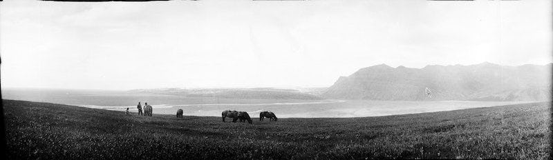
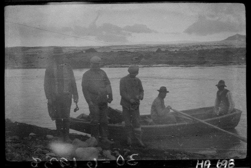
The human settlements in the neighbourhood of Vatnajökull have, over more than a millennium, had to adjust to natural hazards due to changes in the glacier extent, subglacial volcanism, outburst floods and the destruction of farmland by eruptions, glacial rivers and soil erosion. Some of the settlements to the south of the ice cap were barried by glacial rivers and among the most isolated in Iceland until as recently as 1974, when the last river on the ring road (Route 1) was bridged. Before the advent of bridges, ferries were operated on some of the rivers, but as harbor conditions along the coast south of Vatnajökull are difficult, horses were the main means of transport for centuries. Crossing the rivers on horseback demanded skill of both horses and riders, and farmers in the area trained their horses especially for this purpose.
The Öræfi district around Öræfajökull glacier/volcano was devastated in the 1362 eruption and further damage was done to the remaining settlements in a second major eruption in 1727, as well as by numerous jökulhlaups in Skeiðará river. The remaining farms at Skaftafell, Svínafell, Hof, Fagurhólsmýri, Hnappafell and Kvísker are now clustered at sheltered locations between the main paths of jökulhlaups in the Skeiðará river and pyroclastic flows down the slopes of Öræfajökull. The current farm locations are a testament to the struggle of the inhabitants with natural hazards through the centuries.
East of Öræfajökull, the Breiðamerkurjökull outlet glacier advanced over settled areas, mainly in the 17th and 18th centuries, including farms settled by the earliest generations of settlers of Iceland and mentioned in the Icelandic Sagas. Some of these formerly settled areas have again become ice-free as a result of glacier retreat since the end of the 19th century and this area now bristles with activity as one of Iceland’s most popular tourist destination.
Still farther east, erosion by glacial rivers has greatly affected fields and other vegetated areas, particularly near the rivers Steinavötn, Heinabergsá and Hornafjarðarfljót where jökulhlaups from ice-dammed lakes were an increasing problem for the settlements during the Little Ice Age. In later years, large areas devastated by glacial river erosion for centuries have been successfully revegetated and reforested, the Skógey area by Höfn í Hornafirði being a particularly good example. Others, like Skeiðarársandur, are recovering by natural means.